
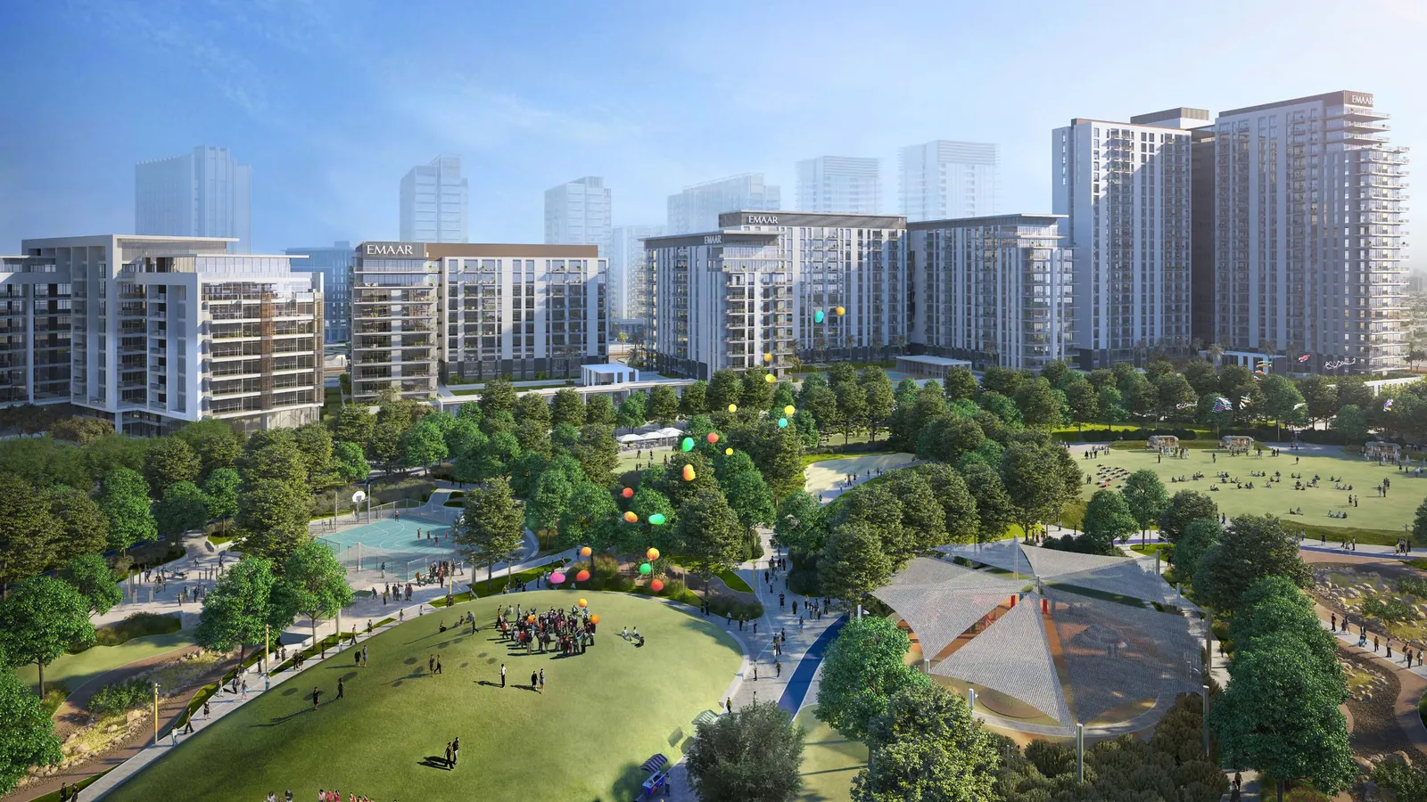
Dubai Hills Estate is at the junction of two major highways: Al Khail Road (E44) and Umm Suqeim Road (D63). The district sits where these highways meet and has direct access to Al Khail Road. In 2020, 13 bridges with a total length of 3.7 km were built here. Together with 2.5 km of approach ramps, the interchange is designed to handle up to 23,500 vehicles an hour.
- What it is.
- A residential district at the junction of Al Khail Road (E44) and Umm Suqeim Road (D63), divided into apartment, townhouse and villa areas around the golf course.
- Getting around.
- Direct highway access, a 13-bridge interchange by the mall, around 10 min to Mall of the Emirates and around 15 min to Downtown Dubai.
- What to bear in mind.
- Dubai Hills Mall has no direct Metro connection. The DH1 circular bus runs hourly.
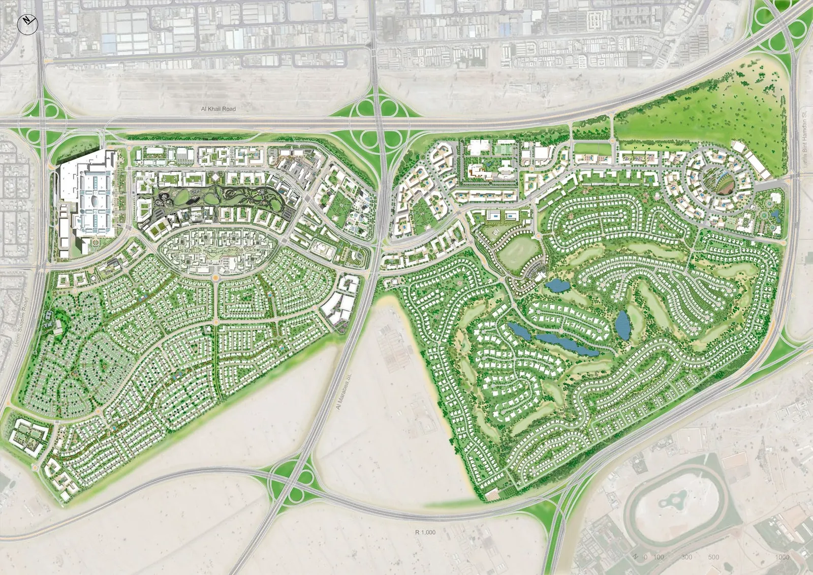
Location on the map: three internal zones and the surrounding districts
Al Barsha South borders the district to the west and south-west. Al Quoz Industrial 2 to 4 define its northern boundary. Living Legends lies to the east.
The district is divided into three parts. The first, a northern and western zone, runs along Al Khail Road beside Dubai Hills Mall. It contains mid-rise apartment buildings in Park Heights, Acacia, Collective 2.0, Mulberry, Gardenia, Park Point and Park Ridge. Majestic Vistas sits just south of this apartment cluster.
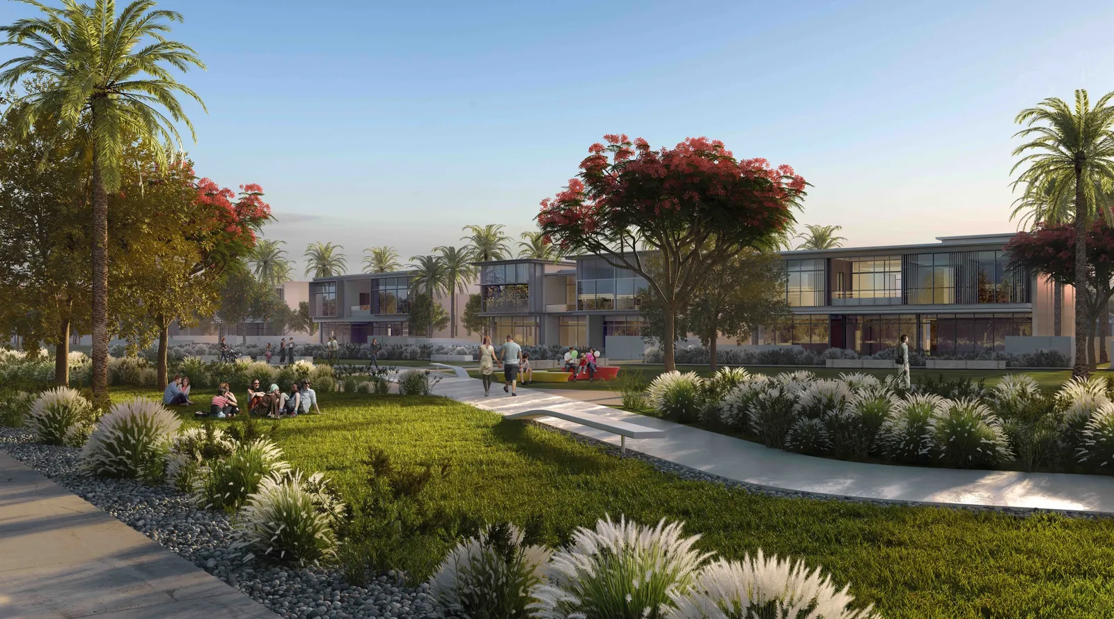
The second zone occupies the central, northern and eastern parts of the district. It is a low-rise area with villa communities around the golf course: Fairways 1 and 2, Fairway Vistas, Hills Grove, Club Villas, Golf Place, Golf Grove, Emerald Hills, Parkway Vistas and Hills View. The third zone extends to the south-west and south. It contains townhouses and villas in Sidra 1, 2, 3 and Maple 1, 2, 3.
Two bordering highways and 13 bridges at Dubai Hills Mall
Dubai Hills Estate borders two major roads. The first is the E44, Al Khail Road, a high-speed highway that skirts the district and provides direct access. The second is the D63, Umm Suqeim Road, also known as Umm Suqeim Street.
In 2020, 13 bridges spanning 3,700 m and 2,500 m of approach ramps were built to link the area with Dubai Hills Mall. Ten of the 13 bridges connect the mall directly to Al Khail Road, while the other three are on Umm Suqeim Street. This system allows access to the mall from three directions: Deira, Umm Suqeim and Jebel Ali.
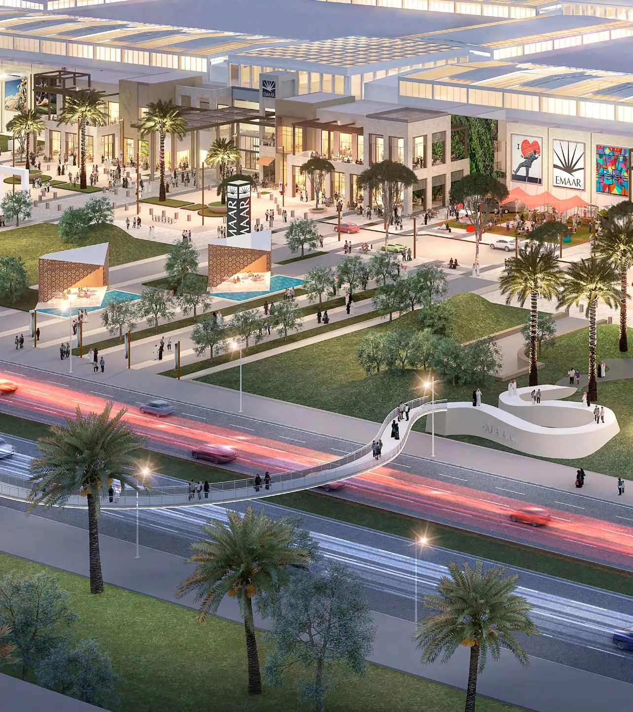
Sheikh Mohammed Bin Zayed Road (E311) runs east of the district and is directly connected to it. It is about 4.3 km away as the crow flies from the Sales Centre in Sidra, and about 5.15 km from Dubai Hills Mall. Sheikh Zayed Road (E11) is around 10 min away by car.
Access via Hessa Street and the Umm Suqeim Street tunnel
Hessa Street (D61) runs north of the district. It is about 3.88 km away as the crow flies from the Sales Centre in Sidra, and about 4.02 km from Dubai Hills Mall. The project covers 4.5 km and cost AED 689 million. On 22 December 2024, a 1,000 m two-lane bridge opened here, providing direct access from Hessa Street to Al Khail Road and cutting travel time on this stretch from 15 to 3 min. By 19 April 2026, the Hessa Street section from Sheikh Zayed Road to Al Khail Road had fully opened.
The 1,000 m two-lane bridge from Hessa Street to Al Khail Road cut travel time on this stretch from 15 to 3 min. The 800 m tunnel on Umm Suqeim Street cut it from 9.7 to 3.8 min.
A tunnel opened on 3 August 2025 on Umm Suqeim Street, between Al Khail Road and Sheikh Mohammed Bin Zayed Road. It is at the junction with Al Barsha South Street, near Kings' School, and is 800 m long. The AED 332 million contract for the works was awarded in January 2024. The tunnel has four lanes in each direction and can handle up to 16,000 vehicles an hour. For Dubai Hills Estate residents, one of the communities served by this interchange, travel time across the 4.6 km section fell from 9.7 to 3.8 min.
Travel times to the centre, airports, sea and business districts
Travel times depend on the destination. Straight-line distances are measured from Dubai Hills Mall.
| Destination | Travel time | Straight-line distance from Dubai Hills Mall |
|---|---|---|
| Mall of the Emirates | around 10 min | 4.53 km (to the Metro station of the same name) |
| Sheikh Zayed Road (E11) | around 10 min | no distance data in km |
| Downtown Dubai / Burj Khalifa | around 15 min | around 11.15 km (to Burj Khalifa) |
| Dubai Marina | 15 or 20 min | around 10.85 km |
| DXB Airport | 20 or 25 min | around 20.98 km |
| Expo City Dubai | around 25 min | no distance data in km |
| DWC Airport (Al Maktoum) | around 30 min | around 22.48 km |
Dubai Marina is 15 or 20 min away, while Dubai International Airport DXB is 20 or 25 min away.
Travel times to the city's beaches are not stated. Straight-line distances from Dubai Hills Mall are available. Jumeirah Public Beach is about 6.92 km away as the crow flies. Al Sufouh beach is around 7.53 km away, while Kite Beach is about 7.61 km away.
Metro and the DH1 bus: how public transport works
Dubai Hills Mall has no direct Metro connection. The stations nearest the district are on the Red Line.
The two nearest stations are 15 or 20 min away by car:
- Equiti (Red Line). The Metro station nearest the district, about 4.26 km from Dubai Hills Mall as the crow flies.
- Mall of the Emirates (Red Line). The second-nearest Red Line station, about 4.53 km from the mall as the crow flies.
Other Red Line stations: InsuranceMarket, by Melodica inside Dubai Hills Mall, is about 5.05 km away as the crow flies; Garmin is about 6.08 km away; and Dubai Internet City is about 6.55 km away. Business Bay is around 10.18 km away as the crow flies, and Burj Khalifa/Dubai Mall is 11.5 km away.
The DH1 circular bus route launched on 5 July 2024, connecting homes with Equiti Metro Station. The bus runs hourly and makes the following stops:
- Dubai Hills Mall. A stop at the mall. From 9 January 2026, the separate Storm Coaster at Dubai Hills Mall stop was discontinued.
- Business Park.
- Acacia 1.
- Park Heights 1.
- Mulberry 1 & 2.
- King's College Hospital.
Road projects: phase 2 of Hessa Street, Umm Suqeim and new highways
Road and cycling projects are planned around the district.
### Hessa Street, phase 2 (Al Khail Road to Sheikh Mohammed Bin Zayed Road section)
The contract for phase 2 of the Hessa Street upgrade was signed on 22 February 2026, and construction began on site in April 2026. The project covers a 3 km corridor between Al Khail Road and Sheikh Mohammed Bin Zayed Road. It includes three interchanges, bridges with a combined length of 8.8 km (8,835 m) and a 480 m tunnel. Once complete, the section's capacity will increase from 4,000 to 8,000 vehicles an hour, while travel time will fall from 24 to 5 min. The project also includes a 10.4 km cycle track connecting Dubai Hills with Motor City. Separately, a 13.5 km cycling and walking route is planned along Hessa Street from Al Sufouh to Dubai Hills, with completion scheduled for the second quarter of 2026.
### Umm Suqeim Street section from Jumeirah Street to Al Khail Road
This project continues the development of the Umm Suqeim: Al Qudra corridor. It was announced on 31 May 2025. Six interchanges, four bridges and three tunnels with a combined length of 4.1 km are planned for the section between Jumeirah Street and Al Khail Road.
### Latifa bint Hamdan Corridor
Construction of the Latifa bint Hamdan Corridor is scheduled for completion in 2028. It will link Sheikh Zayed Road, Al Khail Road and other major roads across the city.
The future of rail travel: the Blue Line, Gold Line and an airport express
Plans for Dubai's expanding rail network include the Blue Line, Gold Line and an airport express.
The Blue Line is due to open on 9 September 2029. It will run for 30 km and have 14 stations. One route will run from Creek through Festival City, Creek Harbour, Ras Al Khor, International City and DSO to Academic City, while another will run from Centrepoint through Mirdif and Al Warqa to IC1. Construction was 24% complete as of September 2026. The line will not serve Dubai Hills Estate.
The Gold Line metro was approved on 22 April 2026. It is a 42 km underground route with 18 stations, costing AED 34 billion. Tendering is scheduled for 2026, contract signing for 2027 and opening for 9 September 2032. The route will run from Al Ghubaiba to Jumeirah Golf Estates, with interchange hubs at Business Bay, Jumeirah Golf Estates, Al Ghubaiba and Meydan.
The high-speed Airport Express Line between DXB and DWC is under study. The proposed route runs from DXB via Al Jaddaf, then along Al Khail Road to a future Gold Line station in JVC and on to DWC. An Etihad Rail station is also planned in Meydan.
What is coming to the community and nearby: new phases, a park, a school and a district with 40,000 homes
Hillside Park is planned within the community. Golf Place Phase 2, an extension to the Maple townhouse area and new towers near Park Heights and Golfville have also been announced.
Harrow International School Dubai is planned on Hessa Street. The site covers 50,000 sq m, and the campus is designed for 1,800 pupils.
On 23 October 2025, a new district called Emaar Hills, also presented as Dubai Mansions, was announced within walking distance of Dubai Hills Estate. Investment will total AED 100 billion. Plans include 40,000 residences, mansions ranging from 10,000 to 20,000 sq ft, a golf course, parks and shops.
Things to keep in mind
Before moving to or buying a home in this area, it is worth considering a few transport and infrastructure points.
- Metro. Dubai Hills Mall has no direct metro connection. The nearest stations, Equiti and Mall of the Emirates, are 15 and 20 minutes away by car respectively, while the Blue Line, planned to open in 2029, will bypass the community.
- Infrequent bus service. The DH1 circular route to Equiti Metro runs once an hour. Its Storm Coaster at Dubai Hills Mall stop was withdrawn on 9 January 2026.
- Road projects nearby. Work on phase 2 of the Hessa Street upgrade, between Al Khail Road and Sheikh Mohammed Bin Zayed Road, began in April 2026. Six interchanges, four bridges and three tunnels are planned for the stretch of Umm Suqeim Street from Jumeirah Street to Al Khail Road.
- Industrial area on the northern edge. Al Quoz Industrial 2 through 4 border the community to the north.
- Travel times can vary. DXB Airport is given as 20 or 25 minutes away, while Dubai Marina is 15 or 20 minutes away.
Who it suits
The community includes apartment, townhouse and villa areas, with its main exits leading to major roads.
| Best for | What the community offers |
|---|---|
| Drivers who work in the city centre or by the sea | Direct access to Al Khail Road (E44) and Umm Suqeim Road (D63), around 10 minutes to Sheikh Zayed Road and Mall of the Emirates, around 15 minutes to Downtown Dubai and 15 or 20 minutes to Dubai Marina. |
| Apartment buyers in the western part of the community | The mid-rise neighbourhoods of Park Heights, Acacia, Mulberry, Collective 2.0, Park Point, Park Ridge and Gardenia sit along Al Khail Road and near Dubai Hills Mall. |
| Families looking for a townhouse or villa | The townhouse and villa neighbourhoods of Sidra 1, 2 and 3, and Maple 1, 2 and 3, are in the south and south-west. The villa neighbourhoods of Golf Place, Emerald Hills, Fairways and Parkway Vistas sit around the golf course to the north and east. |
| Those who value cycling routes | Cycling routes are planned along Hessa Street: a 13.5 km route from Al Sufouh to Dubai Hills and a 10.4 km cycle path from Dubai Hills to Motor City. |
| Those who often fly from both airports | DXB International Airport is 20 or 25 minutes away by car, while DWC (Al Maktoum) Airport is around 30 minutes away. |
Easy mistakes to avoid
When getting to know the community map, four details are worth bearing in mind.
- Overlooking the bus frequency. The DH1 runs in a circular loop once an hour. Stops on the route include Acacia 1, Park Heights 1, Mulberry 1 & 2, Business Park and King's College Hospital.
- Looking for the discontinued Storm Coaster stop. The DH1 stop called Storm Coaster at Dubai Hills Mall was withdrawn on 9 January 2026. The route does stop at Dubai Hills Mall.
- Judging the distance to main roads from a single point for the whole community. The area stretches from west to east. For example, the straight-line distance from the Sales Centre in Sidra to Sheikh Mohammed Bin Zayed Road is 4.3 km, while from Dubai Hills Mall it is 5.15 km. Check the distance from your chosen home to the road you need.
- Expecting a Blue Line station in the community to open in 2029. The 14-station Blue Line will run through Creek, Festival City and International City, but not Dubai Hills.
At a glance
Where exactly is Dubai Hills Estate?
The district is at the junction of two highways: Al Khail Road (E44) and Umm Suqeim Road (D63). Al Barsha South lies to the west and south-west, Al Quoz Industrial 2 to 4 border it to the north, and Living Legends is to the east. Within the district, the land is divided into a western zone of mid-rise buildings by the mall, a southern zone of Sidra and Maple townhouses and villas, and a north-eastern zone of villas around the golf course.
How long does it take to get from Dubai Hills to Downtown Dubai and the airports?
The drive to Downtown Dubai takes around 15 min. The straight-line distance from the mall to Burj Khalifa is about 11.15 km. Dubai International Airport DXB is 20 or 25 min away, with a straight-line distance of about 20.98 km. The trip to DWC (Al Maktoum) Airport takes around 30 min, and it is about 22.48 km away as the crow flies.
Is there a Metro station in Dubai Hills, and how do you get to it?
Dubai Hills Mall has no direct metro connection. The nearest Red Line stations, Equiti and Mall of the Emirates, are 15 and 20 minutes away by car. The straight-line distances from the mall are 4.26 km and 4.53 km respectively. Equiti station can be reached on the DH1 circular bus, which runs once an hour and stops at Acacia 1, Park Heights 1, Mulberry 1 & 2, Business Park and King's College Hospital.
How far are the city's beaches from the district?
Travel times to the sea are not stated. Straight-line distances from Dubai Hills Mall are available. Jumeirah Public Beach is about 6.92 km away as the crow flies. Al Sufouh beach is around 7.53 km away, while Kite Beach is about 7.61 km away.
Which new roads and interchanges have already opened, and which are planned nearby?
In December 2024, a 1 km bridge from Hessa Street to Al Khail Road opened, cutting travel time from 15 to 3 min. On 19 April 2026, the Hessa Street section from Sheikh Zayed Road to Al Khail Road became fully operational. An 800 m tunnel on Umm Suqeim Street opened on 3 August 2025, cutting journey time from 9.7 to 3.8 min. Work began in April 2026 on phase 2 of Hessa Street from Al Khail Road to Sheikh Mohammed Bin Zayed Road. The project includes a 480 m tunnel and is expected to reduce travel time from 24 to 5 min. Six interchanges, four bridges and three tunnels are planned for Umm Suqeim Street between Jumeirah Street and Al Khail Road.
Will the district get a Metro station in the coming years?
The Metro Blue Line, due to open on 9 September 2029, does not run through Dubai Hills. The 18-station Gold Line from Al Ghubaiba to Jumeirah Golf Estates was approved in April 2026. It is scheduled to open on 9 September 2032.
Find a home in Dubai Hills
Neighbourhoods within the community vary by location: the mid-rise buildings of Park Heights, Acacia and Mulberry are near the mall and Al Khail Road; Maple and Sidra townhouses are in the south and south-west; Golf Place and Emerald Hills villas are by the golf course. If you are looking for a home to move into, consider in advance how you will get from it to the places you travel to every day.
[invitation] Get in touch, and we will help you choose a neighbourhood and home in Dubai Hills Estate to suit your routes and your family's needs.